Negative Number: 15978
Latitude: 37.0
Longitude: 175.0
Geographical Classification:
Australia and Islands: New Zealand
Card Front:
Twelve hundred miles southeast of Australia is the British colony of New Zealand. It consists of two main islands, separated by Cook Strait. It is shaped like a boot with the toe pointing upward on the map. In area, it would make almost three states the size of Indiana. The islands contain (1915) 1,162,134 people, of whom a million are Europeans. The islands were formerly heavily wooded. Much of the forest has been cut off so that stock raising and agriculture are the chief industries. Close to these, however, stands mining. Large herds of sheep and cattle graze on the rolling uplands. Wool, frozen meats, butter and cheese, and hides and skins are the chief exports. The annual export of wool amounts to $50,000,000, the frozen meat to $40,000,000, the butter and cheese to $27,000,000, and the hides and skins to $7,000,000. Gold amounting to $8,000,000 is
Card Back:
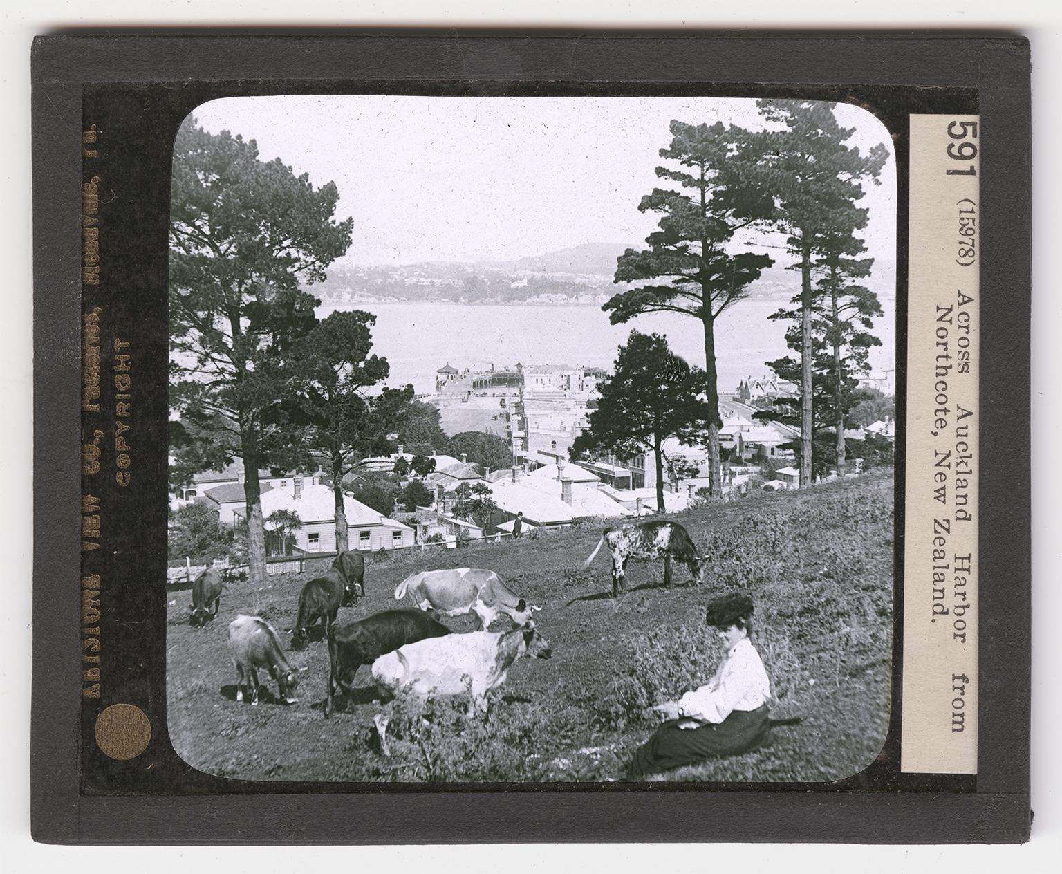
shipped yearly, and the timber exports is annualy worth about $1,500,000. The chief are Auckland and Wellington. With its suburbs, Auckland has a population of more than 100,000. Wellingyon, the capital, contains 70,000 people. You are here viewing one of the pretty suburbs of Auckland, situate on the inlet that forms the harbor of the city. On the opposite shore the city itself can be clearly seen. Auckland is built on an isthmus. It is a beautiful city, with a fine location. Around it are many small volcaoes, none of which are active. One of the islands protecting the harbor has a cone a thousand feet high. The hills are covered with large pines. The importance of the city is due to its fine harbor. Ship building, sugar refining, slaughtering, and brick, rope, and paper making are the chief industries.