Negative Number: 17023
Latitude: 17.0
Longitude: 26.0
Geographical Classification:
Africa: Rhodesia
Card Front:
Africa is indeed the Dark Continent if enlightenment comes with railways. It has very few railroads and, outside the Cape to Cairo branches, these are short. Until 1867 the whole continent has only 40 miles of track. But European countries wished to tap the natural riches of central Africa. To do this railroads were needed to carry the raw materials to the coast. In the hope of striking through the heart of the continent the Cape to Cairo Railway was planned. The Cape means Cape Town at the Cape of Good Hope. Locate. Cairo is a large city in Egypt, on the Nile, and not far from the Mediterranean Sea. Locate Cairo. The railroad as planned would follow the general course of the Nile into the Lake Victoria country. It would then go near Lake Tanganyika into Northeast Rhodesia and
Card Back:
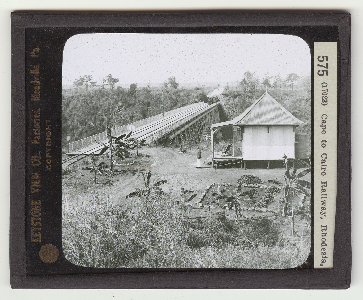
so on southwest to Cape Town. From Cape Town to Northeast Rhodesia 2,000 miles of the road is built. From Cairo to 100 miles south of Khartum some 1,500 more miles are built. This leaves a gap of 1600 miles yet to do. On a map of Africa dot the route of the Cape to Cairo Railway. The view here shows the railway near the Zambesi River, just below the Victoria Fals. The bridge is 650 feet long, and is said to be the highest in the world - 420 feet above the water. The building is the home of a guard who takes fares from foot passengers who cross the bridge - a shilling per person. How much is a shilling? Study the picture of the bridge. Observe the depth of the gorge through which the Zambesi flows. Notice the plants.