Negative Number: 14554
Latitude: 30.0
Longitude: 115.0
Geographical Classification:
Asia: China and Manchuria
Card Front:
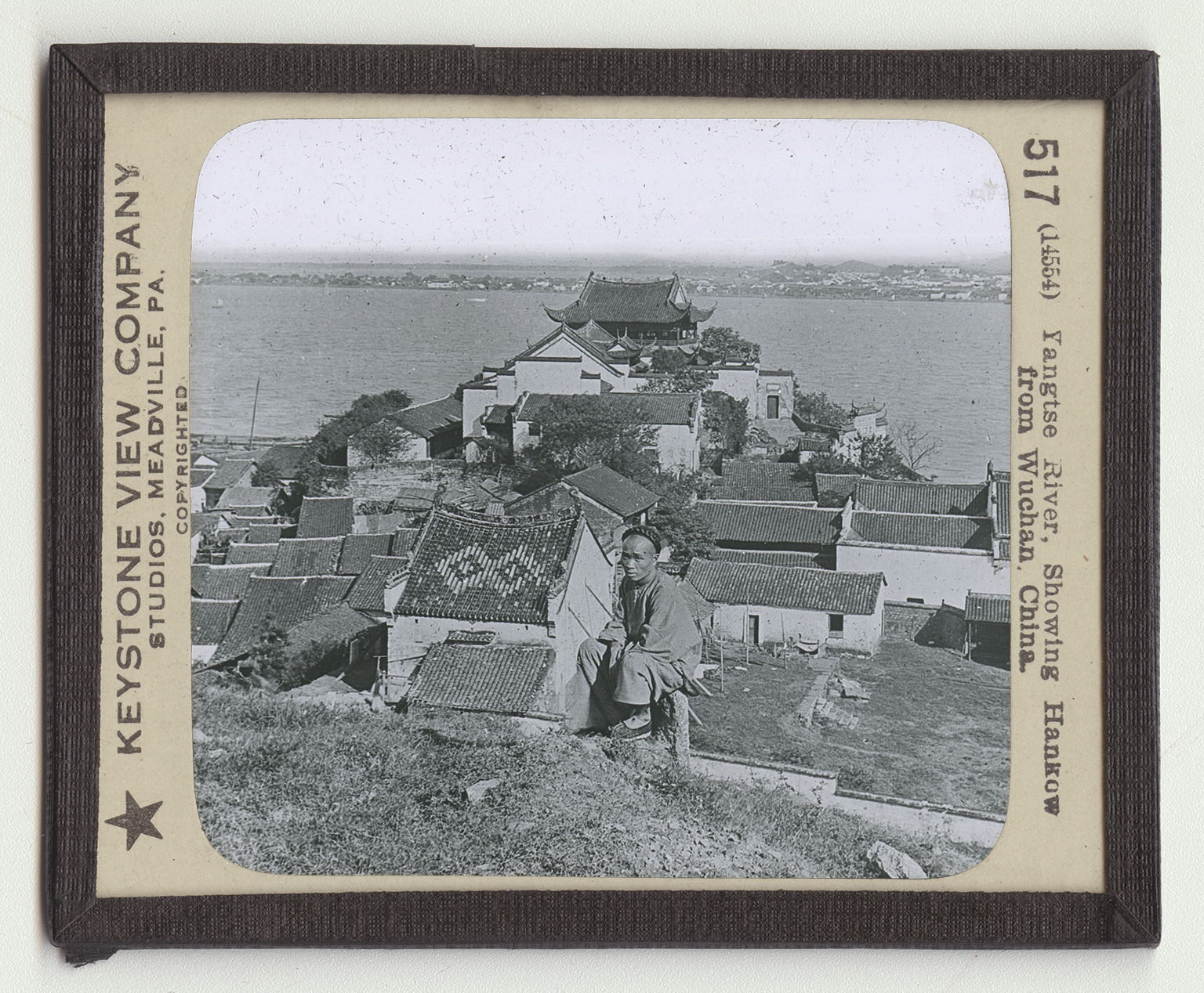
We have here an excellent view of the Yangtze River. The towns here seen are the merest villages, but they show what the Chinese village look like, and also suggest the density of population in the fertile river valleys. You will observe that the houses are covered with tiles. The roof of one is decorated with a beautiful mosaic pattern, so that it looks more like a fine rug than a roof. The Yangtze rises in the eastern plateau of Tibet, where it is fed by the melting snows and glaciers of the Kuenlun Mountains. The upper stretches of the river are fully 15,000 feet above sea level. It rises not far from the head waters of the Hwang River. Not much is definitely known about the highland of Tibet, because travelers are not allowed to go where they please in that section. But Chinese travelers say that the head waters of the Yangtze
Card Back:
and the Hwang are separated by only a single range of mountains. As the river flows eastward it descends rapidly. Part of the way the fall averages as much as 8 feet in a mile. Then this fall decreases to 6 feet and finally to 3 feet. From the great city of Hankow on the ocean, the movement of the water is very slow. This makes the water practically a deep canal from Hankow to the Yellow Sea. During the summer, when its waters are deep, ships of a tongue of 6,000 dock at Hankow. The Yangtze drains an area of 650,000 square miles; that is 3/4 the area of the United States east of the Mississippi. The river is 3,400 miles long. The Nile is 3,766 miles; the Congo, 3,000 miles; the Amaon, 3,800 miles; and the Mississippi and Missouri 4,200 miles long.