Negative Number: 12564
Latitude: 23.0
Longitude: 88.0
Geographical Classification:
Asia: Indian Empire: India Proper
Card Front:
The city of Calcutta is located 80 miles north of the Bay of Benhgal on the east bank of the Hooghly River, one of the mouths of the Ganges. It is the largest city in India, with a population almost equal to that of Philadelphia. It is noted for its commerce, in spite of its poor harbor. In the value of its annual shipping it ranks 10th of all the ports of the world. Its combined imports and exports in the year 1912 amounted to $447,229,559. Its imports consisted largely of manufactured goods, especially cotton goods. Its exports are hides, jute, rice, wheat, indigo, and opium. The city is defended by Fort William, which stands on the banks of the Hooghly. In the city are fine public buildings, beautiful residences, spacious gardens with tropical and semitropical trees, fine open squares, and broad streets. In spite of its dense population, Calcutta is a beau-
Card Back:
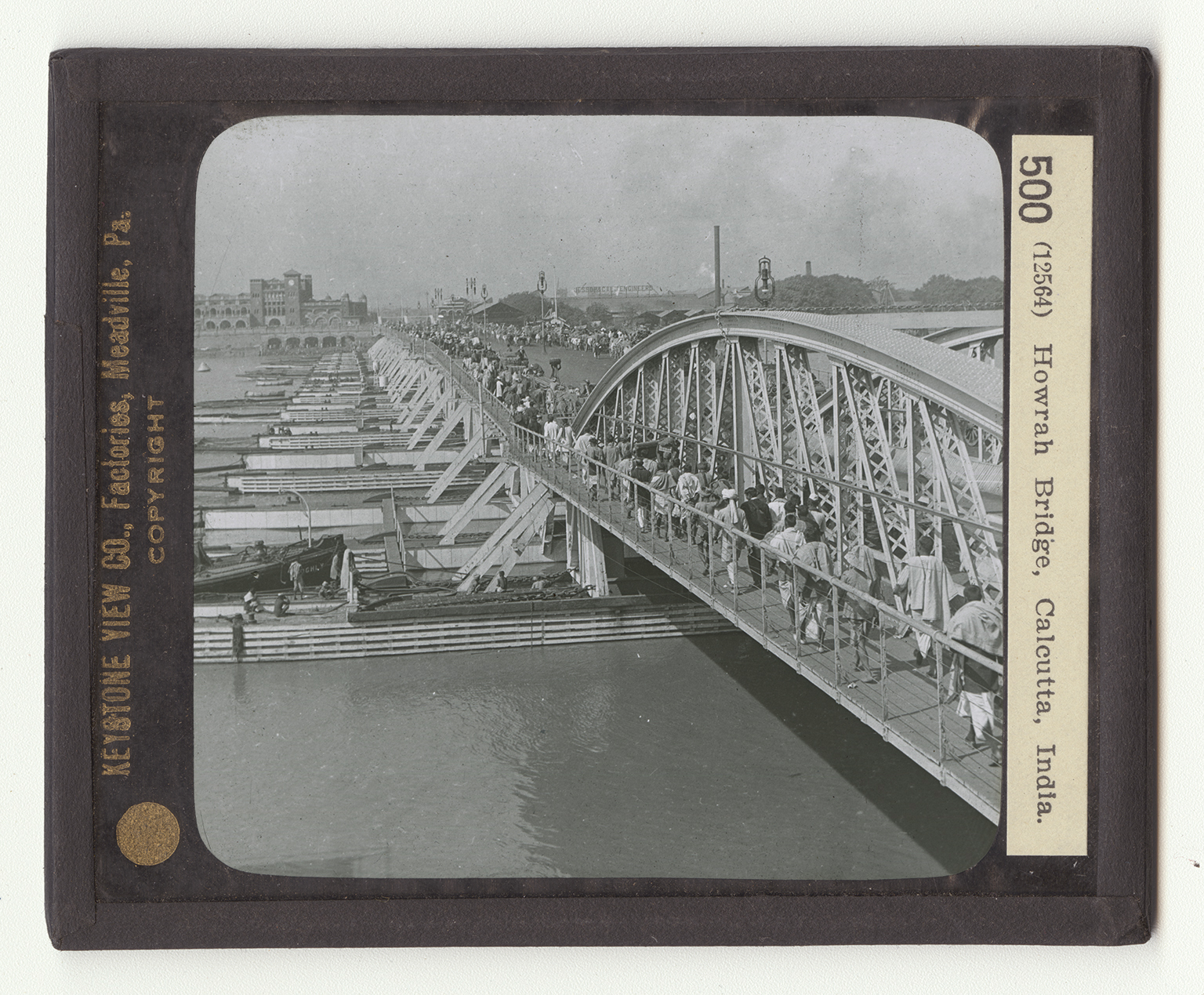
tiful city of magnificent distances. On the east bank of the Hooghly is the suburb of Howrah. Connecting the two is the bridge here shown. This structure is unique in many ways. You will note that it rests upon a great number of wooden supports. You will also observe that the people keep on the lefthand side as they do in most eastern countries, including the continent of Europe. A great stream of foot passengers crosses this bridge all day long. They are largely Hindoos, who make up the bulk population of Calcutta. There are also many Mohammedans. You could hardly think of such a scene as this in America. Instead of foot passengers in our country, you would see a long line of automobiles, trolley cars, busses, wagons, and trains. You observe that many of the natives are carrying burdens on their heads.