Negative Number: 7178
Latitude: 41.0
Longitude: 29.0
Geographical Classification:
Europe: Turkey
Card Front:
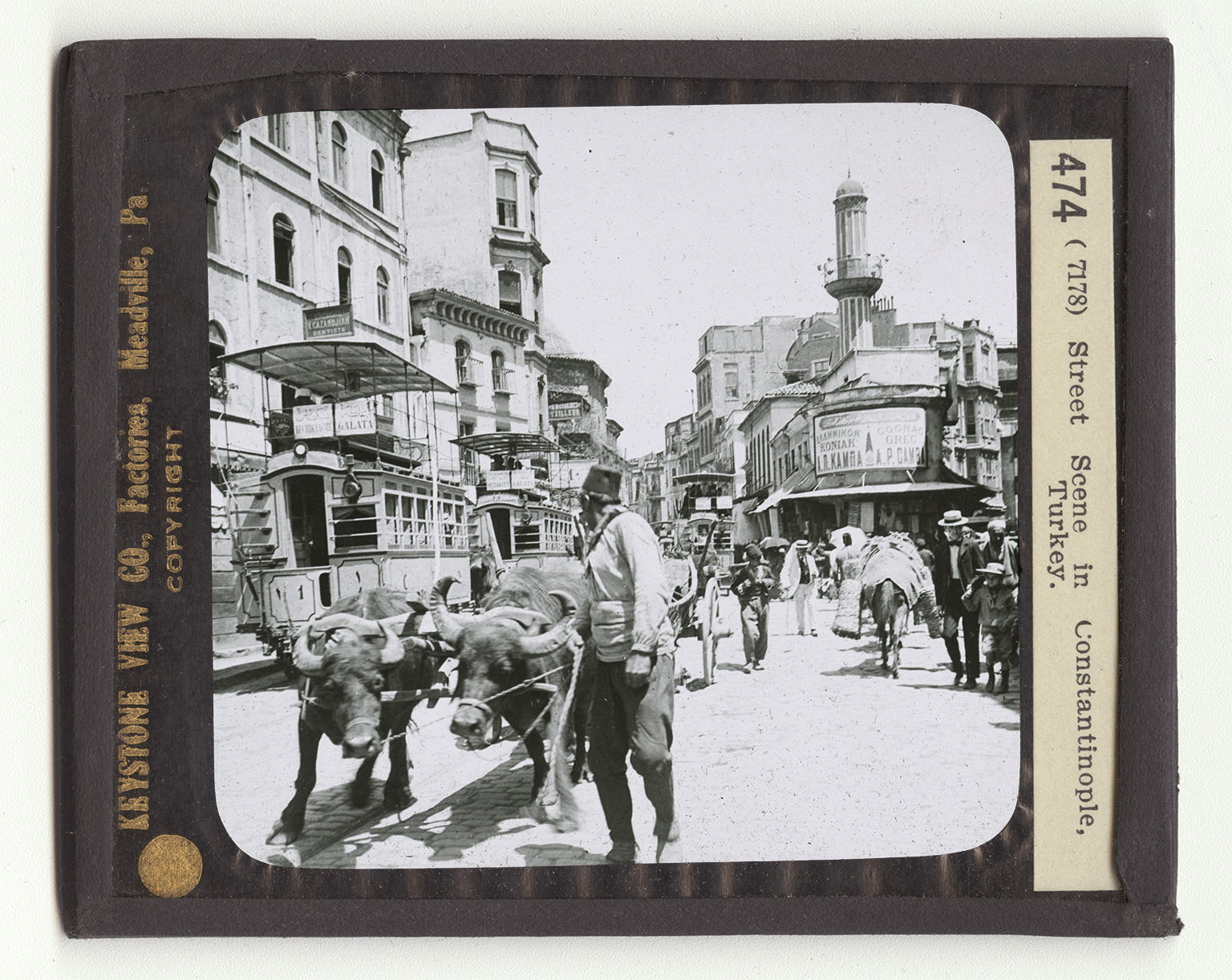
Constantinople is on the western side of the Bosporus. The Bosporus is a strait of water some 18 miles long connecting the Black Sea with the Sea of Marmora. If you look at your map you will see that the Sea of Marmora is connected with the Aegan Sea, a branch of the Mediterranean. The city is on the main roadway between Asia and Europe. Its harbor about the Golden Horn is large and deep. Its capture by the Turks led to the discovery of America. Constantinople is a city of about 1,125,000 people, or about twice the size of Cleveland. It was founded by the Greeks 700 B.C. and was then called Byzantium. It later belonged to the Romans. One of the emperors, Constantinople, made it the capital of the Roman Empire. It is from the emperor
Card Back:
that its name comes. The city was captured by the Turks in 1453. The Turks made it the capital of their empire also. It is a very important port, its combined shipping amounting in 1912 to $103,000,000. It exports grains, silk, opium, gum, wool, and hides. We are in the European quarter of the city. Many of the important thoroughfares are narrow like this lane of stone steps which leads to the Grand Rue of Pera where the fashionable shops are located. Most of the people here are Turks, but Armenians, Bulgarians, Greeks, Jews - almost every race is represented. Buying goods here is always a slow process. The seller always asks more than he expexts to get, the buyer offers less than he intends to give. It takes a long time to make a bargain.