Negative Number: 15607
Latitude: 48.0
Longitude: 16.0
Geographical Classification:
Europe: Austria-Hungary
Card Front:
The Danube, next to the Volga, is the largest river in Europe. It is about the length of the Rio Grande, but it is far more important. It is the only long southern highway of fresh water between eastern and western Europe. It rises in south Germany where one of its arms is linked by a canal with one of the tributaries of the Rhine. Eastward and southward it takes its course across Austria-Hungary, bordering Serbia on the north. For 350 miles it is the boundary between Roumania and Bulgaria. Finally it turns northward across Roumania, and marks the line of separation between that country and Russia. It empties into the Black Sea. The river touches or crosses 5 countries, 3 of which are powerful empires. On its banks are the capitals of two nations and one dependent country. These are Vienna, Belgrade
Card Back:
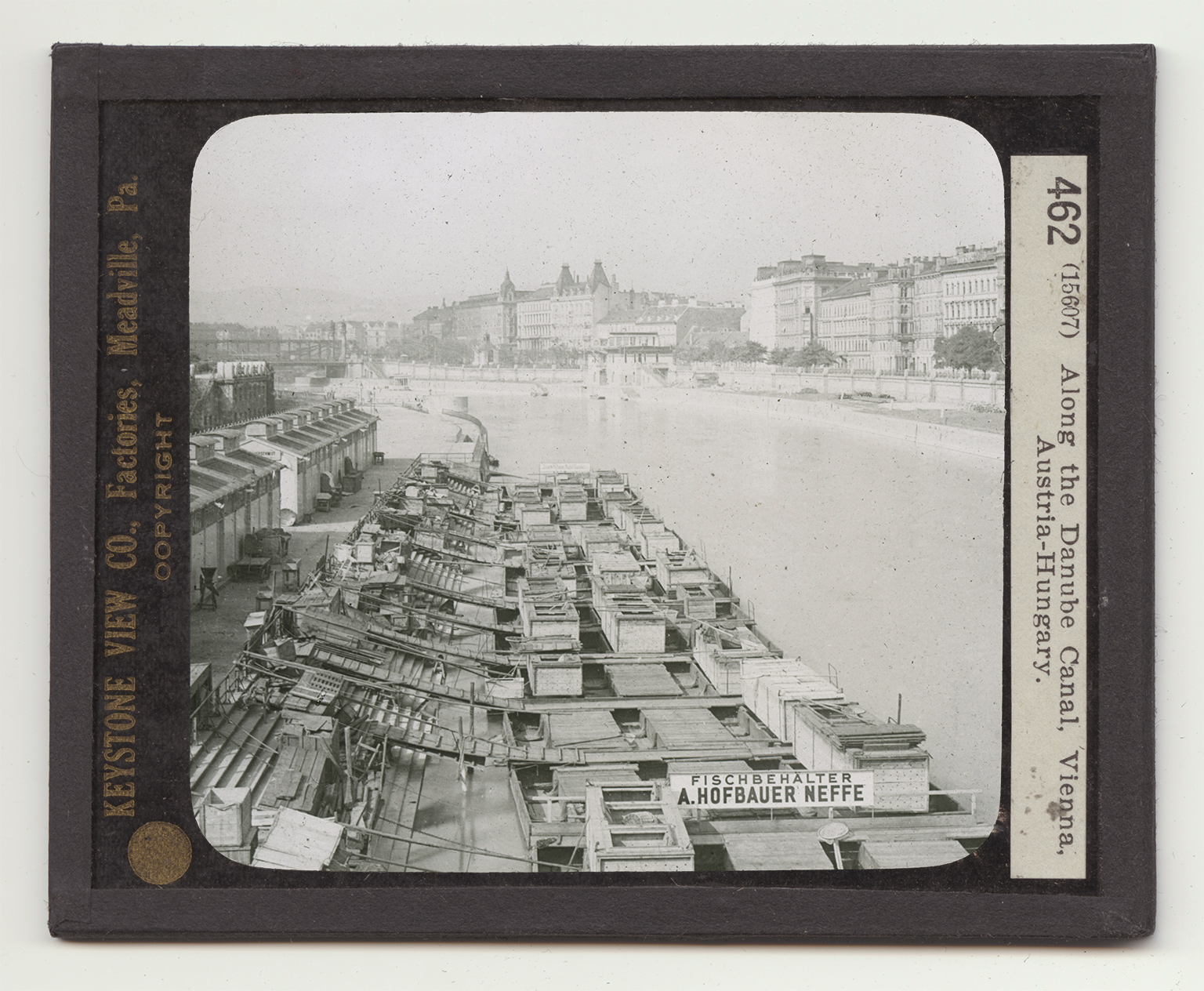
and Budapest. About 3 miles northwest of Vienna the river breaks through hills of limestone into the Viennese valley. The main body of the river flows on the north of the city. To keep it from flooding, the river has been made into a canal for a distance of 8 miles at a cost of nearly 15 million dollars. The river branches just outside Vienna so that one arm flows through the heart of the city. This, too, has been made into a canal - the one you see. On either side, and floating on the canal, are warehouses and fish depots. On the canal is carried a great deal of the city's freight traffic. It is fitted up with fine stone and concrete quays. At either end of it, where it connects with the Danube, are winter harbors. The canal was built in 1869-73.