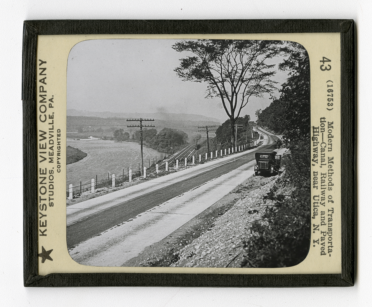
Slide 43
Modern Methods of Transporation—Canal, Railway and Paved Highway, near Utica, N. Y.
Negative Number: 16753
Latitude: 43.0
Longitude: 78.0
Geographical Classification:
North America: United States and Possessions (Except Asiatic Possessions): Middle Atlantic States: New York
Card Front:
The United States has by far the greatest transportation system of any country in the world. San Francisco and New York are only 5 days apart. Chicago and New York are separated by only 20 hours. In the very center of the view is the splendid four-track system of the New York Central Railway. This railway directly connects Buffalo and New York. But with the other roads connected with the system, it binds together many parts of the country, westward to Chicago and St. Louis. Here you see a fast passenger train on one of the inner tracks, and a freight going in the opposite direction on one of the outer tracks. But it is not by railroads alone that we transport goods. In the first half of the 19th century many canals were constructed. The first and the largest of these was the Erie Canal, connecting the Great Lakes with New York and the Atlantic
Card Back:
seaboard by way of the Hudson River. The first Erie Canal was built from 1817 to 1825 at a cost of over $7,000,000. Governor DeWitt Clinton of New York fathered the scheme. It is this canal that you see at the extreme left of the view. A new Barge Canal has now taken the place of the Erie Canal. This system follows, in the main, the old Mohawk trail. You can readily trace the canal on a map of New York. It is more than 350 miles long, and can carry over 20,000,000 tons of freight annually. Many locks and dams have been built to operate the canal. In 1909 the tonnage carried on the canal system of New York was 3,116,536. On the extreme right of the view is an electric railway. These railways, often called "Interurbans", form perfect spider webs all over the eastern states and the Middle West.