Negative Number: 10115
Latitude: 50.0
Longitude: 5.0
Geographical Classification:
Europe: Belgium
Card Front:
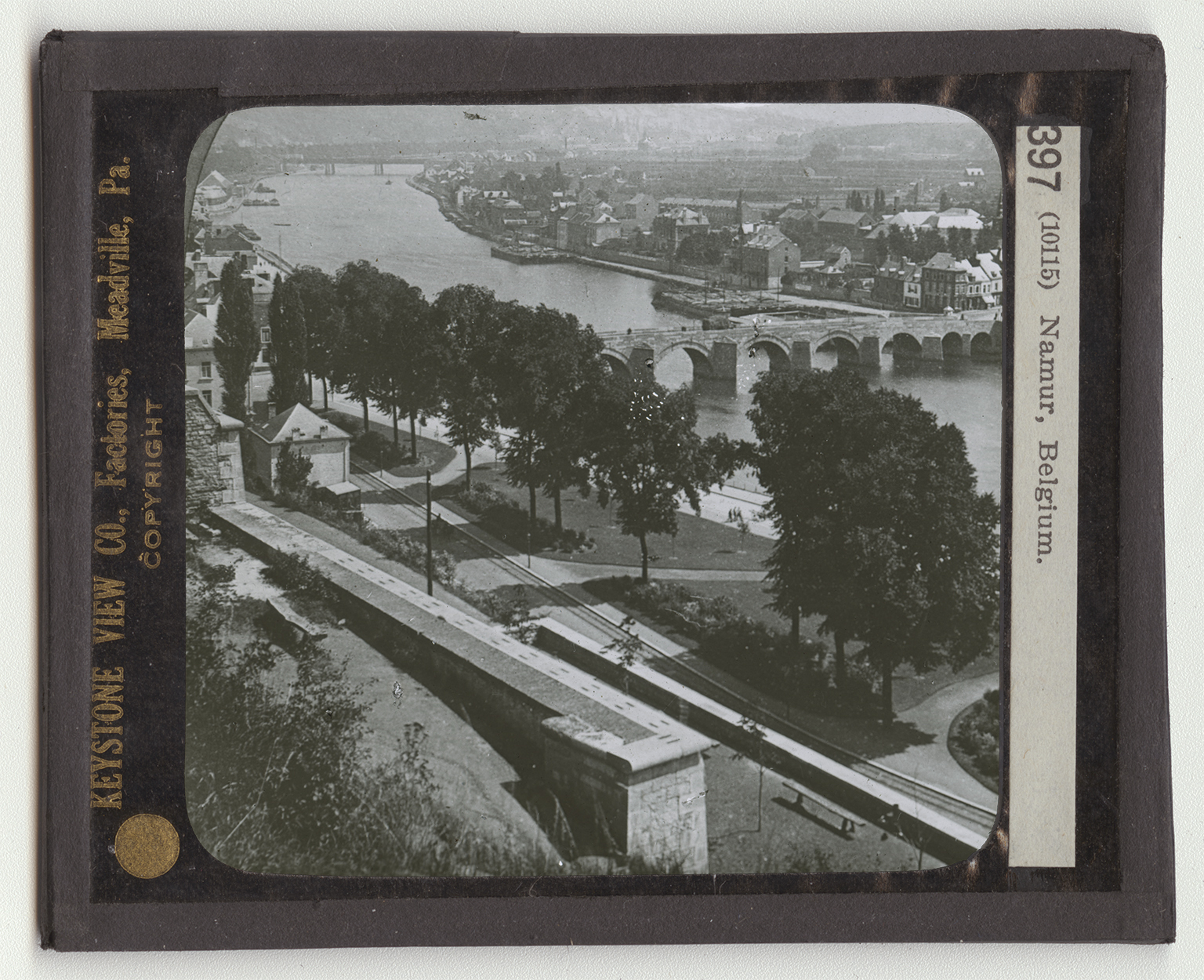
Where the Sambre River flows into the Meuse the city of Namur is built. The country is hillt, and is rich in iron and coal. The section of Belgium south of the Meuse furnishes the iron to make Belgian machinery, and the coal to run its factories. The Meuse River is also the natural line of the defense for Belgium against Germany. Namur has therefore seen its share of the battles in which unhappy Belgium has been so often plunged. In the fall of 1914 the German army battered down the forts of Liege (le-ezh'), 30 miles above Namur. Then it marched upon Namur. The view shows the park behind the old fort of Namur, and the Meuse River with the stone bridges across it. The park consists of 160 acres, well laid out with drives, shrubbery, and trees. The place where the fort or Citadel is, was once the campting ground of a tribe of warriors's against whom Caesar hurled the Roman legions.
Card Back:
The city is a manufacturing center. It makes cutlery chiefly. But is also manufactures pottery, glass, and porcelain. It has two fine cathedrals. The population of the city is less than 50,000. It is the capital of the Belgian province of Namur, and is 35 miles southeast of Brussels. Since the time of Caesar, Belgium has been one of the chief fighting grounds of Europe. This is partially due to its location, and partially to the levelness of the land. Perhaps its best known battlefield is that of Waterloo, where Napoleon was defeated. On your map find Namur and Liege. Trace the course of the Meuse. What little country borders Belgium on the southeast? What large country lies south of it? What country is on the west? Which way is Holland from Belgium? Which way are Holland and Belgium? Why are Holland and Belgium called the Low Countries?