Negative Number: 13508
Latitude: 41.0
Longitude: 74.0
Geographical Classification:
North America: United States and Possessions (Except Asiatic Possessions): Middle Atlantic States: New York
Card Front:
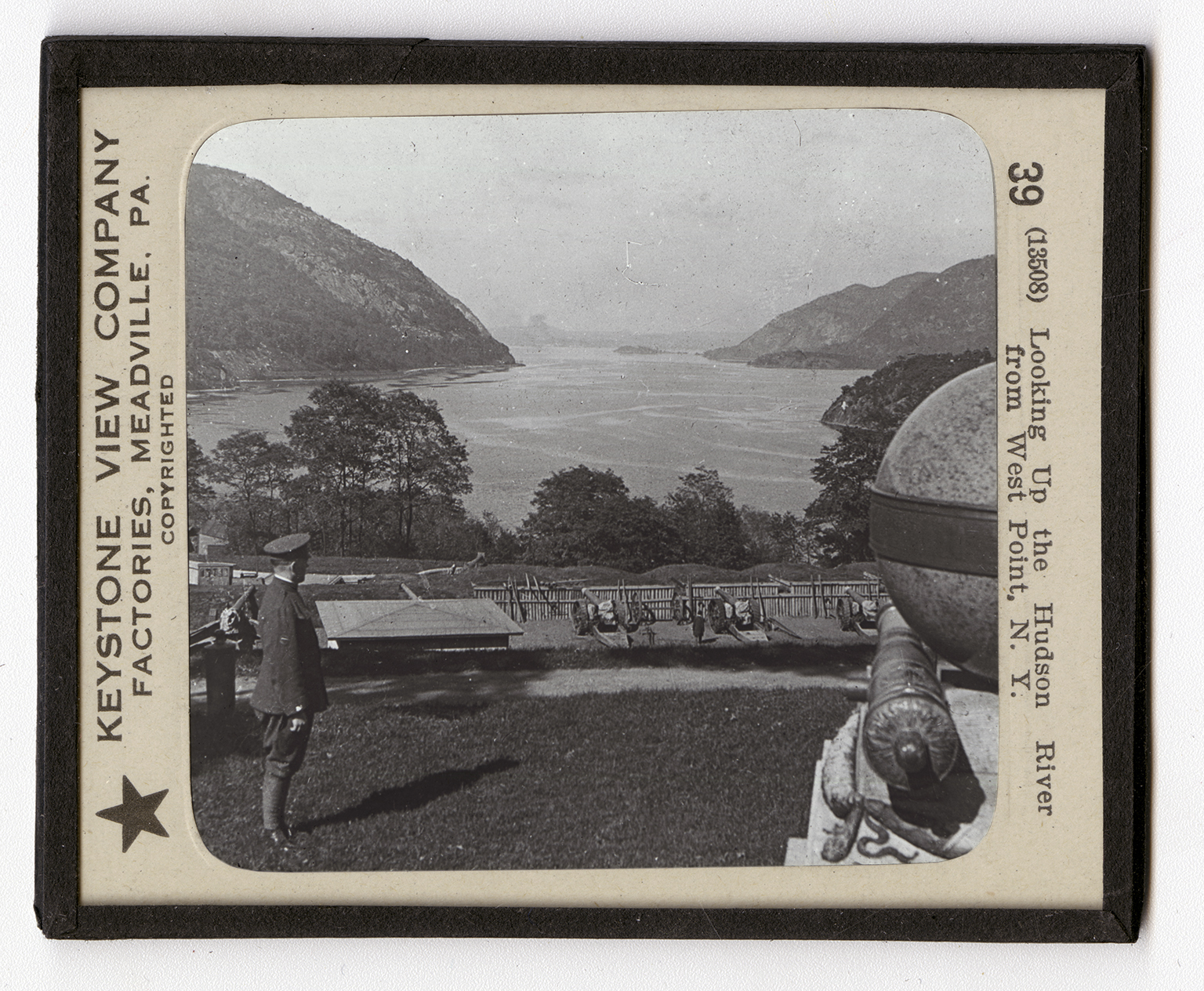
West Point is the seat of the United States Military Academy. It has long been a military post. You will recall that an important fort stood here during the Revolutionary War. During that war the Hudson River was the key to the campaigns. The British planned to cut the colonies in two by seizing the land up and down the Hudson. To do this, the plan was for the British troops in New York to march northward under General Howe. Burgoyne was to come southward from Lake Champlain West Point was the chief port on the line. It was in command of General Benedict Arnold. Through the spy, Andre, the British got in touch with Arnold, who agreed to sell the fort. This part of the plan broke down, because Andre was captured at Tarrytown on his way back to General Howe's lines. In 1790 the United States Government took
Card Back:
up a reservation of 2100 acres of land to be used as the seat of a training school for army officers. This has been added to until there are now 3319 acres on the west bank, and 280 acres on the east bank of the Hudson. The Academy was opened in 1802. The government has built fine quarters for cadets and residences for the officers. There are many buildings in which are the class rooms and the gymnasiums and the library. The buildings are grouped about an open court which is beautifully laid out. It is used for a drill ground. Here every day the cadets are put through military formations. At West Point most of our great military officers have been trained. From this point you are looking north up the Hudson.