Negative Number: 12456
Latitude: 42.0
Longitude: 74.0
Geographical Classification:
North America: United States and Possessions (Except Asiatic Possessions): Middle Atlantic States: New York
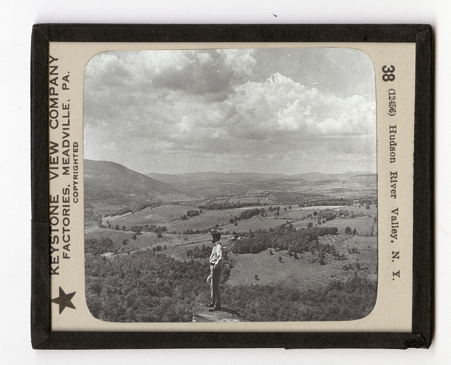
Card Front:
The Hudson flows in a north and south direction from the Adirondack Mountains to New York harbor, a distance of 300 miles. It may be roughly divided into two parts: the portion above Troy, which is not navigable and which is broken by rapids and falls, and the portion below Troy, which is navigable and also tidal. The entire Hudson Valley has been worn out by what is called erosion; that is, it has been worn away by water, freezing, etc. At one time it was probably a great river connected with Lake Champlain. At another time it was likely an arm of the ocean and the New England States formed an island cut off from the mainland. When the land about the river lifted still later, the land about the mouth of the Hudson sank so that the waters of the sea now come much farther inland than they once did. This we know, be-
Card Back:
cause we can follow the mouth of the Hudson far beyond Sandy Hook. This shifting back and forth has made the valley of the Hudson very irregular. The valley for the most part appears to be very narrow--in many places only a gorge. But the real Hudson Valley, in its full width is shown in the view. You see it is a double valley, the smaller valley being only the middle part of the larger one. The river is the center of the greatest traffic system in the United States. Its mouth forms a goodly part of the fine harbor of New York. Great steamboats sail from New York to Albany. The New York Central Railroad uses the valley on the east side of the river, and the West Shore Railroad, the west side. Near the sport here shown, in the Catskills, Rip Van Winkle took his long sleep.