Negative Number: 16751
Latitude: 41.0
Longitude: 74.0
Geographical Classification:
North America: United States and Possessions (Except Asiatic Possessions): Middle Atlantic States: New York
Card Front:
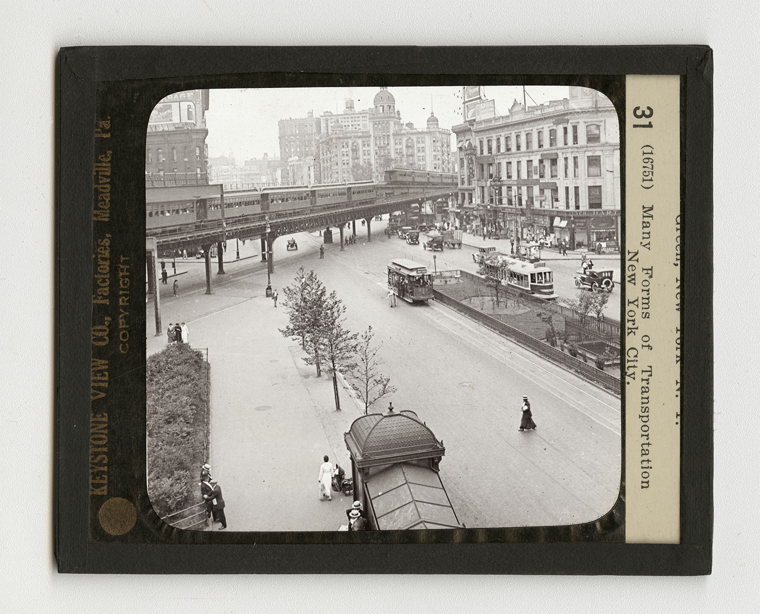
New York is the largest city in the United States and the second largest city in the world. London alone is larger, and even this statement is now questioned. Within the city limits there live about 5,000,000 people. Perhaps another million live in nearby cities but come into New York every day to work. To carry these people back and forth is the city's biggest problem. This view shows many ways by which New Yorkers travel. The Sixth Avenue Elevated Railway is directly in the center of the view. You observe two crowded trains, one going north, the other, south. Besides the Sixth Avenue Elevated, there is on the west side of the city an elevated system on Ninth Avenue. On the east side of the city there are two other main lines. Two types of surface cars are shown. Surface cars run on all the chief avenues running
Card Back:
north and south, with the exception of Fifth Avenue. In all, there are 17 surface lines running north and south. To bind this system together there are 22 cross-town lines. In the immediate foreground is an entrance into the subway. No city in the world has such a system of subways as has New York. When the entire system, as planned, is completed, together with its elevated railroad connections, this Rapid Transit System will cover nearly 630 miles, and will have cost about $350,000,000. Subways run under East River, connecting Brooklyn and Manhattan. The Subway railroad trains carry nearly 1,000,000 people daily. The Hudson Tubes, an independent subway system, extend a fourth of the length of Manhattan Island, and then go under the Hudson River to Hoboken, Jersey City, and Newark.