Negative Number: 16316
Latitude: 50.0
Longitude: 97.0
Geographical Classification:
North America: Northern Countries of North America: Canada
Card Front:
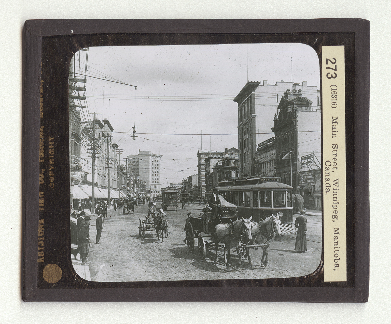
The greatest city in Canada west of the Great Lakes, is Winnipeg, the capital of the province of Manitoba. It is the center of the Canadian transcontinental railways, You will observe on the map, that is is some 40 miles south of the lake of the same name. It is in the heart of the wheat raising district and much of the development of the city has been due to this product. Great grain elevators and flouring mills are located here. The city has a population of almost 140,000. That is, it is about the size of Syracuse, N.Y., or of Birmingham, Alabama. As the view shows, it is a metropolis in every sense of the world. It has 6 banks, is the center of the famous Hudson Bay Company's stores is the seat of the University of Manitoba, and has several colleges and normal schools. It has large manufacturing interests. Its factories are engaged in producing lumber, flour, linseed oil (from flax seed),
Card Back:
boots, shoes, harness, saddles, clothing, and arms. But at the head of the list of its products stands grain. It is the leading grain-exporting market in the British Empire. Winnipeg is built where stood the Hudson Bay Company's fur-trading post known as Fort Garry, built in 1822. There had been earlier forts here, but Fort Garry was the beginning of the Winnipeg colony. The province of Manitoba is greater in extent than either France or Germany. It lies in the Red River Valley. The rich land has been farmed extensively in wheat. Manitoba No. I Hard Wheat is considered the finest variety of wheat grown. Lake Winnipeg is a shallow body of water, dotted with islands. It is not deep enough for navigation. It is almost as large as the state of Connecticut.