Negative Number: 21787
Latitude: 9.0
Longitude: 80.0
Geographical Classification:
North America: United States and Possessions (Except Asiatic Possessions): Outlying Possessions of the United States (Except the Philippines and Guam): Panama, C. Z.
Card Front:
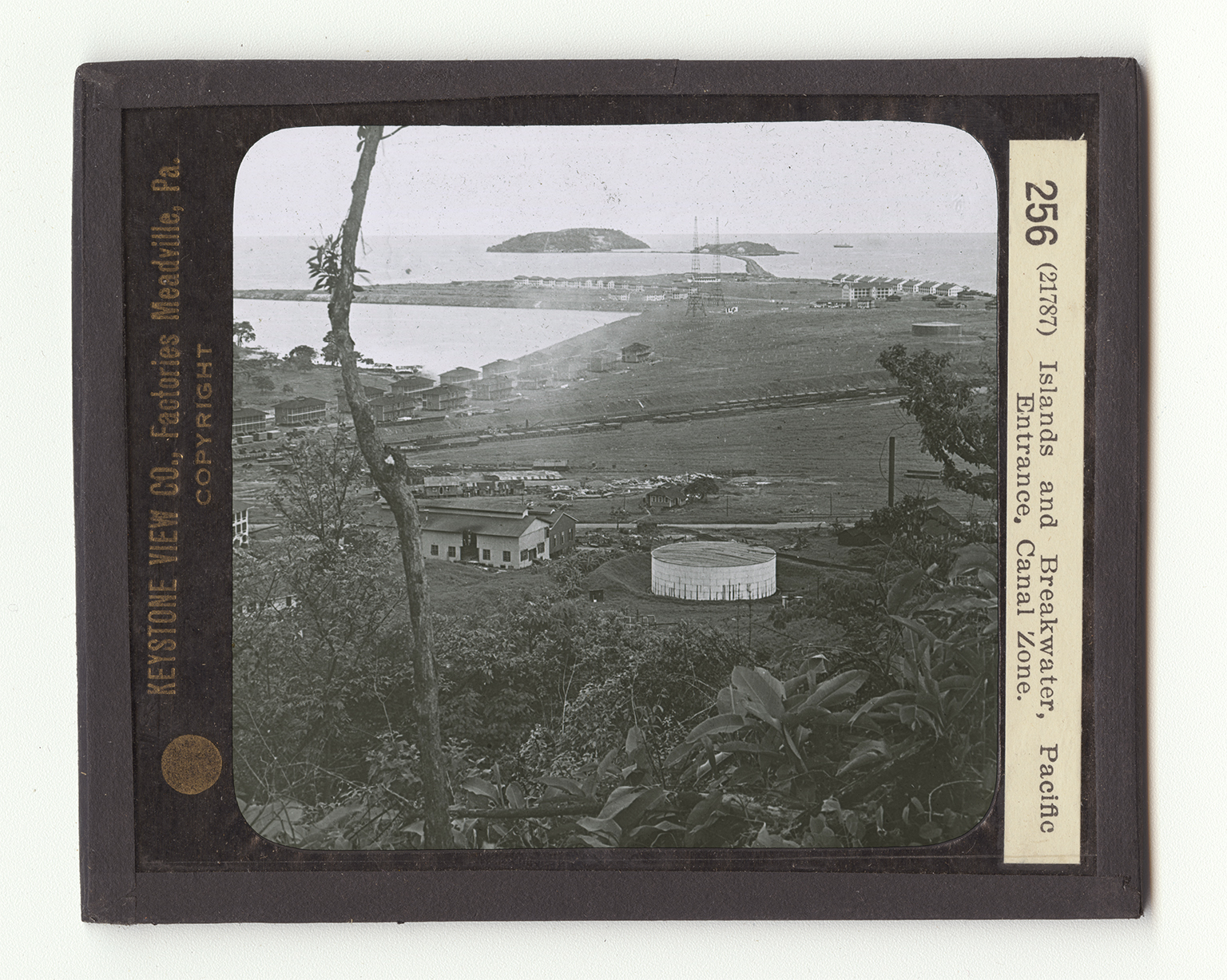
The Pacific end of the Panama Canal is shown to you here. The Canal lies just beyond the long breakwater. The breakwater is not a natural peninsula. It has been built by our Government engineers who constructed the Canal. This breakwater was necessary to protect ships from the high waves which would otherwise break in from the Pacific Ocean. In other words, a sort of sheltered entrance has been made by the breakwater and the three islands which you see lying in the background. These three islands, called Naos, Perico, and Flamenco, are heavily fortified, to protect the Canal in times of war. This is a very important point, since one reason for the building of the Canal, was to enable us to bring our fleet from one ocean to the other through the Canal. The Pacific entrance to the Canal is near the
Card Back:
city of Balboa. The Miraflores Locks are about four miles inland from the Pacific. In Balboa, there have been constructed great shops for repairing ships and a large dry dock for the same purpose. The cities at either end of the Panama Canal will develop rapidly, due to the opening of the Canal. If you turn your maps and notice where the cities of panama and Balboa are located, you will see that they are almost due south of Colon at the Atlantic end of the Canal. In other words, the Panama Canal is almost in a direct north and south line from Florida to Guyaquil, the seaport for Lima, Peru. All the western countries of South America are therefore put in close touch with our eastern cities.