Negative Number: 13635
Latitude: 45.0
Longitude: 122.0
Geographical Classification:
North America: United States and Possessions (Except Asiatic Possessions): Pacific States: Oregon
Card Front:
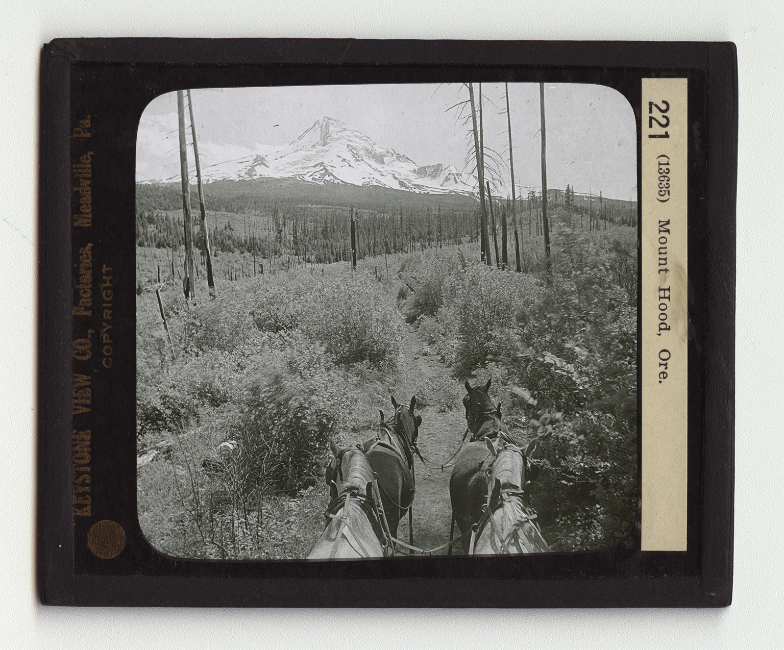
The Cascade Range of mountains is crowned by many noble peaks. The peak nearest the Columbia River on the south is Mount Hood. This mountain was once a volcano, but it has long ceased to be active. It rises 11,225 feet above the sea level. It is snow capped the year round. Its peak is visible from the ships on the Pacific Ocean and its white top stands out in plain view of Portland, 50 miles northwest. Though it is almost 2 miles high, Mount Hood is not a difficult peak to climb. One of the common ways of approaching it is from the Cloud Cap Inn in Hood River County. This inn is 5,827 feet above the level of the sea. Hundreds of tourists each year leave the inn in small crowds, led by a guide. The climb a great part of the way is as easy as the path here shows it to be. But in the upper reaches of the mountain the path is steep. Here the climbers are roped
Card Back:
together to keep any one of them from falling over precipices. From the mountain top its great glacier winds down to the valley like a flattened snowdrift. Peak after peak of the Cascades stand out sharply to the north and to the south. Mount Adams, far beyond the Columbia River, looks to be only a few miles away. There are many things of interest to be seen in the vicinity of Mount Hood. The scene here shows well the upper limits of tree growth. This is called the tree line. The land here shown is in Hood River County, a great part of which is forested with pine, fir, and larch trees. It is estimated that this country alone has 1,125,000 feet of lumber. The Hood River Valley is known all over our country and Canada for its fruit, especially its apples and strawberries.