Negative Number: 14135
Latitude: 47.0
Longitude: 122.0
Geographical Classification:
North America: United States and Possessions (Except Asiatic Possessions): Pacific States: Washington
Card Front:
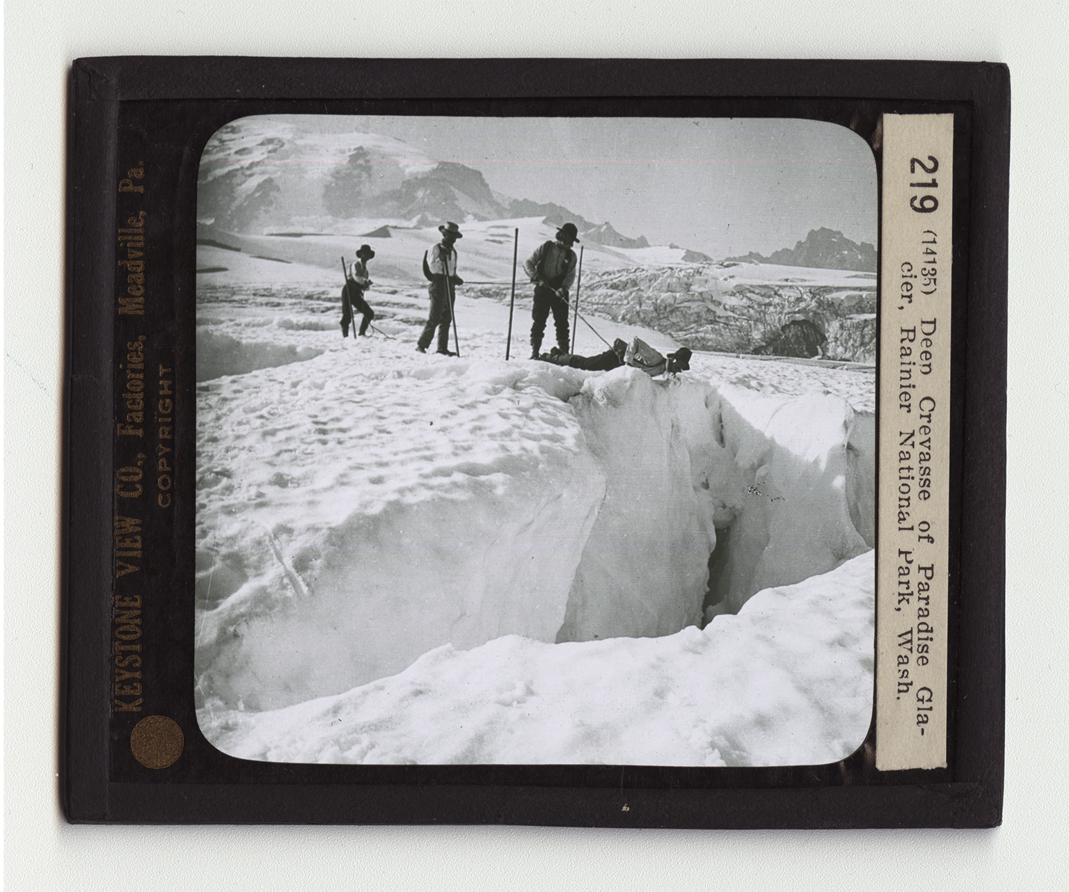
The Mount Rainier National Park is in west central Washington. The park was established in 1899 and contains 324 square miles. This park contains the largest single-peak glacier system in the United States, which can be readily reached. In all there are about 28 glaciers which cover 48 square miles. These glaciers range in thickness from 50 feet to 500 feet. The view here shows one of these great glacier fields slowly moving down from the summit of Mount Rainier. This ice-covered peak stands out sharply in the background. The men here are exploring the glacier. They have come to the huge crevasse which cuts the glacier sharply at this point. One of the men is taking a view of the bottom of this crevasse which is hundreds of feet below. He is taking no chances. You will notice that the man directly behind him is holding him by a strong
Card Back:
rope, which, in turn, is being held by each of the other two men. In mountain-climbing, the three of four men in the party are connected with each other by a rope fastened at their waists. If one of them loses his footing, the others can drag him to a point of safety. You will observe, too, that each of the men is equipped with an alpenstock, a pole with a sharp point. Mount Rainier is a giant peak 14,480 feet above sea level. Even though it is far in the interior of Washington, its sublime summit charts the way for sailors far out at sea. The mountain was formerly some 2,000 feet higher than it now is. But a volcanic explosion ripped its peak off. In its crater are now formed the glaciers which slowly move down the mountain side in 28 separate valleys. Find Mount Rainier on your maps.