Negative Number: 2459
Latitude: 41.0
Longitude: 112.0
Geographical Classification:
North America: United States and Possessions (Except Asiatic Possessions): Plateau States: Utah
Card Front:
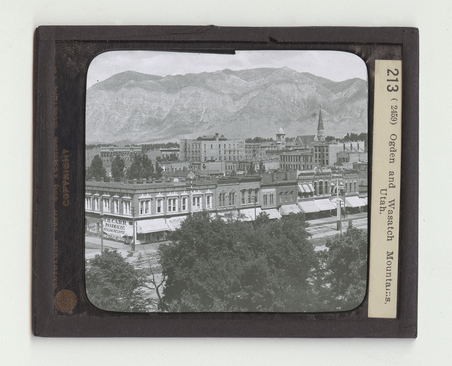
Name the states that border Utah. The southeastern part of Utah is drained by the Colorado River and its tributaries. In the northern part is the Great Salt Lake. The Wasatch Mountains, a spur of the Rockies, run north and south across the center of the state. East of the Great Salt Lake is the city of Ogden. It is 37 miles north of Salt Lake City. It is at the junction of the Ogden and Weber Rivers. The first of these furnishes the power for the heat and light of Ogden and Salt Lake City. It is a city of about 30,000 inhabitants and is located on one of the great trans-continental railway lines. It is one of the largest railway centers between Denver and the Pacific Coast. Its chief industries are the manufacturing of beet sugar and canned goods. It has extensive railway shops. All about the city are mines of gold, silver, and iron.
Card Back:
The view shows the way in which the city nestles at the foot of the Wasatch Mountains. You can tell from the part shown that it is a modernly built, up-to-date city. Of what are the stores built? Are there many or few trees? The Wasatch Mountains rise in the southeastern part of Idaho and extend across the state of Utah almost to the Colorado River. This range forms the eastern boundary of the Great Basin, including parts of Utah, Nevada, and Idaho. The mountains are rich in minerals, especially coal, iron, and silver. South of Ogden their slopes are covered with pine forests. Their average height is about 10,000 feet, but there are some peaks that rise 2,000 feet higher. The section of the range here shown is barren of trees. You can see great scars across the face of the rock cliffs, showing where they have been eroded.
