Negative Number: 16757
Latitude: 29.0
Longitude: 89.0
Geographical Classification:
North America: United States and Possessions (Except Asiatic Possessions): South Central States: Louisiana
Card Front:
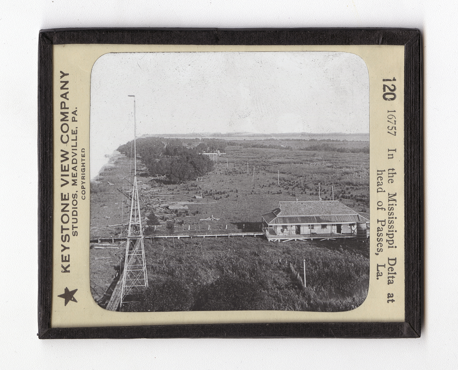
The Mississippi River System is in many ways the greatest in the world. The river rises in the Northern Minnesota in Lake Hernando de Soto beyond Lake Itasca. This is about 2,500 miles from the place shown in the view. Where it rises, the land is about 1,472 feet above sea level. It flows almost due south. Its largest tributary is the Missouri River. The Mississippi and the Missouri, taken together, are 4200 miles long. Forty-four tributaries of the Mississippi are navigable. One of the most interesting places along the Mississippi is at its mouth where it flows into the Gulf. Here it has built up islands of earth brought down from above. These islands in the mouth are called the delta. This is because in the mouth of the Nile River the island there is in the shape of the Greek letter Delta, formed like a triangle. Naturally all this dirt makes the
Card Back:
water shallow, and spreads it over a great area. To deepen the channel, the Government built jetties from opposite points on the banks out into the river. These were constructed by driving piles into the mud and making a basketwork of willows between the piling. When the spaces between the willows filled with mud, there was a solid wall which caused the water to flow swiftly between the ends of the jetties. In this way the river is forced to wash out its own channel. These are called the Eads Jetties because the engineering was done by Captain Eads, the man who built the bridge across the Mississippi at St. Louis. The jetties cost about $6,000,000, and were completed in 1879. The place here shown is where pilots are taken on the large river steamers. These pilots guide the steamers through the waterways.